Leg 41 – Flat Rolling, and More Flats, to Riley

6/17

I made about 68 miles today, to Chickahominy Reservoir in Riley, Oregon, though I will have to backtrack seven miles tomorrow for the next leg.

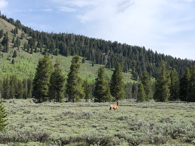
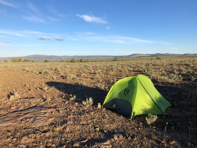
It was a quiet night on the high desert, with only cricket sounds until the dawn birds sang. Wild horses visited me at breakfast.

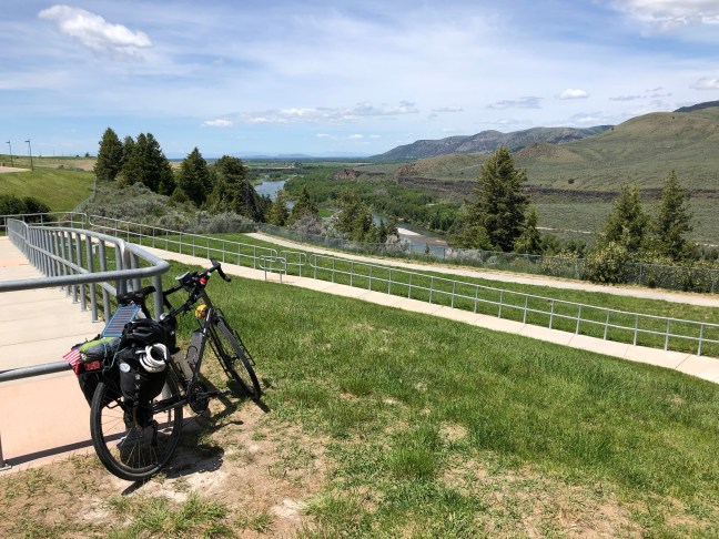
The day got off to a good start, with a long downhill from Stinkwater Pass, and the vast plain ahead promising little climbing for the morning. I met a couple on an eastbound trans America bike tour, pushing their bikes up to the top of the pass. He thought the sporting goods store in Burns would be big enough to carry bicycle tires and tubes. I ran into Dave and Naomi again at the rest area at the bottom of the hill, and filled my water bottles from their tank again, saving a stop at the gas station down the road. All was well as I cruised down the flat valley. Even the tire that was losing air every three miles yesterday seemed to be holding pressure for fifteen miles.

Just outside of Burns, I had to pump up the front tire again. When I tried to cinch down the valve really tight, the valve rod broke off. The stem was too short for the rims, and too much pumping with a hand pump jammed tight had worn the metal. Even without the nut, the tire held air, so I hurried off to find the sporting goods store three miles away on the other side of town. But I was hitting my rims after two miles, and had to stop. I could walk the bike the mile. But maybe I should call first. B&B Sports did not sell bicycle accessories, as it turned out, but the Big R or the Rite Aid would have tubes and patch kits, I was assured. They were across the street from where I stopped.

The Big R did have tubes, but not the right size or valve type. So I bought a patch kit -25 more patches if needed. The Rite Aid also did not have the right sized tubes. So I bought another patch kit and a spare pump, since I had begun to worry about how sunk I would be if I lost or broke my one pump. I could now fix about 50 flats, if needed, but I could not fix a broken valve stem. The one that broke had only been on the bike for two days. That worried me, since I was down to one spare tube – and that one with a short valve stem.

So I put my twice patched, long stemmed tube on the front wheel, then went grocery shopping while I was there, then went to Boomers Place restaurant in neighboring Hines, OR, for beer and an early lunch and possible solutions with a WiFi connection. I made reservations for tomorrow night at the Christmas Valley Desert Inn. Then I went to Amazon, and tried to buy new tires and tubes for overnight shipment to the motel. At first, it seemed an option, then the overnight option disappeared. I googled “Bicycle Tires Overnight Shipping,” which led me to a seller in Portland, Oregon, which claimed that UPS standard shipping would deliver two new tires and two new tubes in Christmas Valley tomorrow. I figured it was worth a try.

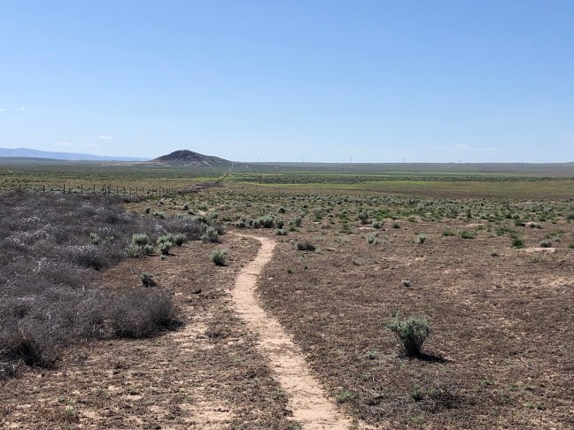
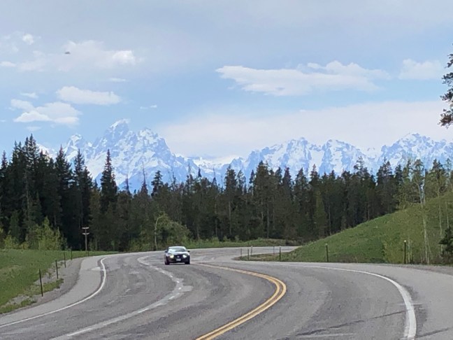
After lunch, I headed west for Riley and the BLM campground at the Chickahominy Reservoir. The road climbed again to a pass of sorts, more flat high desert dotted with pines but smothered with sagebrush. One thing about bike touring – you are very sensitive to the different smells of different places. The sage range in Oregon smells different from sage in Idaho or Wyoming or Nebraska – I would say it has a hint of chocolate to it.

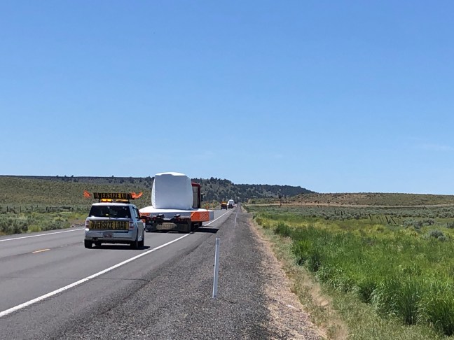
Several times today I was passed by frightening wide load trucks. The first time, the lead vehicle honked at me and I looked behind to see this shoulder-sweeping behemoth coming up to me. After that, I pulled over for every wide load lead vehicle not take any chances.

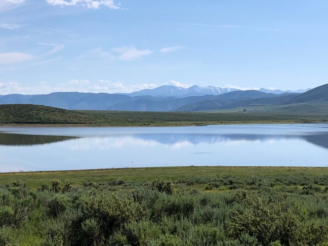
I got to Riley, and its only little store, at around four, and used their outlet to charge my phone while I drank a beer. Dave rode in, fully loaded up, since Naomi had headed back to Portland with the van. He was going to camp at Chickahominy, also, and had confirmed at the BLM office that water was available at the campground.

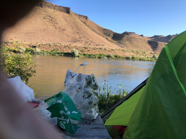
It was still another seven miles of riding, but a very pleasant place on the reservoir and nice to have company for the evening. Dave is also a sailor, so we shared sailing stories over dinner and the box of Cabernet I bought back in Burns

Advertisement

Leg 40 – Climbing the Malheur Canyons to a High Desert Campsite

6/16 posted late

I made about 85 miles today, from Vale, Oregon to the Stinkwater Wild Horse and Burro Management Area at the top of Stinkwater Pass.

I got an earlyish hotel start, with no hotel breakfast to delay me. On the road at 7 am, I remembered why early morning starts are important in the desert. The air is cool,and still.

Rt 20 followed the Malheur River, and the vistas soon became grand. Each bend revealed a steeper, taller, drier, and redder mountain, with no visible path for the road to follow. And though the road was ever climbing, the anticipation of the grander view around the next bend distracted me from the work of pedaling.

My original goal for the day was the Chukar BLM Campground six miles up a gravel road from Juntura, at mile 55. Juntura also had a motel, and I assumed if it was big enough to have a hotel, it would have some sort of groceries, too.

At mile 22, as expected, there was a gas station in Harper. But the highway sign said “next gas 68 miles.” That was way beyond Juntura. I stopped at Coleman’s Gas. Even though no signs advertised a bar or cafe, inside the building there was a bar with a few people drinking Sunday morning beers, and a snack counter. I bought a Pepsi, and asked if there was really no gas or groceries in Juntura. The guy at the counter said, that’s right, no groceries until Burns.

So I rode off up more canyons pondering how I might put together a camping dinner and weather I should waste a beautiful still day for just sixty mikes of progress. I convinced myself that Burns was 68 more miles, a very doable 90 mile day. Burns was a good sized town with several motels and stores. I had no internet to confirm my plan.

So I rode higher and higher up the arid valleys, the Malheur River mysteriously brimful in this dry place. But as I gained altitude, the hills got greener, the air a little cooler, and then pines began to dot the hillsides. I pictured lunch in the shade of a pine tree, but they all seemed to be on the wrong side of the cattle fences, so I settled for a cottonwood with soft tall grass beneath it.

After a high pass, the road dropped into Juntura, and I dropped into the Cafe Oasis to reconnoiter. I ordered a Corona with lime, and asked the waitress where the next grocery store was going west. She said Burns. I had enough signal on my phone to see that Burns was still 68 mikes away. “I thought there was a gas station about 35 miles from here.” “There is, But they don’t have groceries, just chips and snacks like we have here.”

So I drank my beer, then a chocolate milkshake, and pondered. I could stay right there at the Oasis and have their burgers and fries for dinner. I could hope to find something better in Buchanan Springs, where the gas station was, but there was no place to stay there.

Someone asked me to move my bike to get at the ice chest outside, and asked me about my trip. Later, the same bunch of guys were at the register loudly paying for eighteen blocks and six bags of ice. “Must be some party you are having,” I said. “We’re going camping in the desert north of here, and we’re going to need it.”

“Maybe you can tell me, then, is there any place to camp in the desert west of here on Route 20?”

“Well,” said the guy who had asked about my trip, “if you go to the top of the second pass west of here – Stinkwater Pass – the first Pass is Drinkwater and the second Pass is Stinkwater – there’s a gravel road into the BLM Wild Horse Management Area, and you’ll see some campsites there.”

“ is that after the gas station in Buchanan?”

“No it’s before. Once you get in the valley, the land is all private and you can’t camp.”

So I had a plan. But dinner would have to be what I could cobble together from the snack counter at the Oasis. So I bought some barbecue flavored beef jerky, citrus punch, two bottles of water, and a quarter pound of their homemade fudge. I figured I could cook the beef jerky with the half box of couscous I still had, and it would be pretty close to an authentic Oregon Trail meal.

So I made the long climb into the pines up Drinkwater Pass, then dropped into the Malheur Valley. Where a bridge crossed the Malheur, I drank all the water left in one bottle and filled it with Malheur water, figuring I could cook with it at my dry high desert camp.

When I got back to my bike the front tire was flat again. I patched it, found the hole in the tire where something had punctured it, and put the wheel back on the bike.

A short ride and a drop into the Stinkwater Creek valley, and my tire was getting soft again. I pumped it up and pedaled on, counting the miles to my high camp, wishing I had replaced my tires in Casper, and worrying about water.

After several more pump stops and the climb up Stinkwater Pass, I finally reached the BLM gravel road. I pedaled down the high sage plain. Something tawny ambled across the sage away from me. It seemed too small for a horse, but it did not walk like a cat.

I lay my bike down and started to set up camp. A tall white van with faded lettering “heating and cooling” on the side came up the road from down the valley and stopped. The woman who was driving smiled and waved. I waved back. A skinny, shirtless young man popped out of the passenger side. I did not immediately register that he, like me, was wearing bike shorts.

“Looks like you are riding unsupported,” he said. “We saw you in Juntura. Is there anything you need? Would you like a cold beer?”

“YES!” I said, “ did God just send you?”

So I had a beer, filled up my water bottles from their tank, chatted. Dave was riding across Oregon, east to west, and Naomi was supporting him with the van – just for the weekend. They were also going to camp here for the night. Dave was ready to share his stock of spare inner tubes, but we figured out that they had the wrong valves – Schraeder instead of Presta, which was wrong for both of us.

Beef jerky couscous tasted just fine. I bent my tent stakes in the rocky soil, and enjoyed a brilliant moonrise over the high desert

Leg 39 – Smooth Rollings (and Some Flats) Down the Snake River Canyon to Vale, Oregon

6/15

I made 77 miles today, to Vale, Oregon.

It was another quiet night away from traffic. The night sounds included the gurgle of the Snake River over a rock at the rivers edge, the lowing of cattle, and the now familiar coyote calls. But there was one night sound I have been dreading, and it came last night – the sound of an animal in my food sack. It’s hard to carry critter protection on a bike camping trip. Some campsites have bear lockers; this one did not. I opened my tent flap and lit my bike light to see a huge raccoon pawing at my food bag hanging from a railing. The raccoon was startled and tentatively walked away. I followed him with my light beam, his eyes glowing back at me. The raccoon walked back to the bag, and I followed it with my beam. Then the light must have spooked it, because it ambled off into the brush. I lay awake, sure he would be back. It he didn’t come back and my food bag was unmolested in the morning.

I got a late start again, since I stopped to chat with the campers who had offered help with my lost cell phone last night. Also, my front tire was flat again, so I put in a new tube and checked (carefully I thought) for thorns inside the tire.

I was looking forward to a paved ride down the Snake River today, but the first road Google sent me on, “Laughlin Lane,” turned out to be a very rocky Jeep track. I had to walk mt bike up the hills. The Jeep track petered out in the scrub near a large dairy operation – the first of many large dairy CAFOs I would see today, Google wanted me to climb the chain link fence and ride through the cows, but I rode on the gravel road around the perimeter instead, which eventually lead to a series of paved country roads labeled as the Snake River Canyon Scenic Byway.

There were nice views of the broad canyon, the green irrigated fields, and the rugged buttes either side. Eventually the route crossed the Snake and followed some smaller and smaller backroads. When Google said “Turn right” without naming a road, I stopped to check the map a short way down the soft sand Jeep track. When Google tells you to turn, but can’t name the road you are on, I have learned to be cautious. It turned out that well paved Idaho Rt 95, just 1/2 mile away, went in the same direction and would be much faster.

But my new tube was also leaking now, and I had to stop several times to pump it up. I stopped in the shade of trees near a residence, and thought I would patch the tube, but dogs were barking at me and I remounted the wheel, pressing on for the town of Homedale, which looked large enough to offer cold drinks and water. I was bottoming out on my rim when I pulled into the gas station in Homedale. I bought a Pepsi and asked to fill my water bottle, then went outside to the bench in the sliver of shade and drank the Pepsi. I then removed the wheel and inner tube, listened carefully for the leak, and eventually found a pinhole so small it was indistinguishable from the natural imperfections in the tube. I reluctantly opened the glue tube in the patch kit (once opened, it will harden and become unusable in a week or so). I patched the tube and felt around the tire where the pinhole was, but found nothing. I the took off my glasses and inspected the tire tread very closely in a way that only a severely myopic person is capable of. I found a thorn where the pinhole was, and removed it with pliers. I removed some other bits of glass and gravel embedded in the tread while I was at it.

The afternoon rollings went better with a firm front tire, and after some random turns on paved back roads that google sent me on, I arrived at a small, weathered, green sign that said “Entering Oregon.” So I am there – I really have ridden a bike from New York to Oregon. Now when people ask me where I am headed, I can’t say “Oregon” anymore. So I will have to say “the Rogue River” now.

Oregon is even drier and more desertlike than Idaho. It got to be lunchtime, but there were precious few shaded spots, and those that were were covered in prickly scrub. When I got to Adrian, the Mirage bar had a bench outside with its sliver of shade, and a sign that said “beer to go.” It was dark inside. I asked what was on tap and the barmaid pointed to a refrigerator full of canned beers. I chose a blood orange ale, because I didn’t get my orange juice this morning. I drank it at the bar then went back out to eat some PB&J sandwiches with the leftover provisions I am trying to use up. Check out the bumper stickers on that car.

After some five more miles on paved back roads, I reached an intersection. Straight ahead, the sign said “Dead end.” Google told me to go right on Borges Lane, where the sign said “Road Closed to Through Traffic.” I checked the map. Borges Lane was supposed to take me across the Owyhee River, but if the bridge was out, I would have to backtrack five miles and find another route. So I went on, figuring that maybe the closed bridge was crossable or there was some other way to cross the river. As it turned out, the closed section was some rough gravel in the bed of the Owyhee River, with a culvert. It was a dry tire crossing.

After some more turns, google sent me up Lytle Boulevard, which followed the long arid Owyhee valley and climbed and climbed and climbed for seven miles. Despite the extra hydration of a third bottle of water, a Pepsi, and a beer, and despite being at low elevations now, I was again feeling tuckered out and running out of water. Near the summit of the climb, there was a shaded historical marker for the route of the Oregon Trail. Even though there was no bench, I lay down on the cement for a restorative rest in the shade. Then I climbed the rest of the way to the top of the pass, and freewheeled down the long grade into the green trees of Vale, Oregon.

Google said the Bates Motel could be found on the west side of town. When I got there, a sign on the run down motel said closed (though it might have meant the Bates Pizza place) and the “No” was lit up in the “No Vacancy” sign, even though there were only three vehicles parked in front of the twenty units. As I swung my bike around to go look downtown for another option, I saw a white haired man out by the residence and I shouted to him. “So the motel is closed?” He shouted back “No, do you need a room.” “I do,” I said. So I checked myself in to the Bates Motel and took a nice cool shower.

Leg 38 – My Private Idaho to Oregon Trail

6/14

I made 76 miles today, to Celebration Park in Melba, Idaho, practically in sight of Oregon. Although the mileage was much less than yesterday, it was a much tougher ride, since two thirds of the ride was on hot dry desert dirt and gravel roads, Jeep tracks, and some horse trails.

I got a late start, since I was parting from Robin, who was going to drive the rental car back to the airport and fly home. After three miles on the better dirt road from Fort Running Bear, I was back on Rt 20, in a section of sagey hills with some steep climbs.

Historic markers on this stretch of road inform the traveler that you are following the path of Goodale’s Cutoff, an alternative to the Oregon Trail scouted by one Goodale. Apparently, native born Americans defending their home from foreign invaders had made the traditional Oregon Trail too dangerous for the European settlers. That’s not what the signs saiid, though. The signs called them hostile Indians. That’s funny. Perspective is everything.

Most the way down a hill on Route 20, at mile 15, Google told me to turn right, on Immigrant Road, a maintained desert dirt road. This was not a bad move, as the road led through a classic desert pass to open sagebrush range. The trip included several historical markers about the Oregon trail, including Barrell Canyon.

The Google did one of those Google bike routing things, and told me to turn left into the sagebrush. Letting Google do bike routing for you reminds me of a game my good buddy Adam Spater and I used to play when we were kids. We called it Magical Mystery Tour. We would write “left,” “right,” and “straight” on scraps of paper, put them in a bowl, then drew out the random directions, which we wrote down on a piece of paper. We then got on our bikes and followed the directions at each intersection, most often ending up at a suburban dead end, but sometimes ending up at that last piece of undeveloped land we called the Butterfly Fields.

Following Google bike directions has a similar randomness to it, though the directions are not keyed to actual roads or intersections. You follow a random Jeep track into the sagebrush, then where Jeep tracks diverge and you follow the “wrong” one, Google yells at you to “head north for 600 feet, make a U turn, then turn right” when you are staring at trackless sagebrush and prairie grass. I rode and walked some of these trackless sections. Fortunately, I had enough of a cell signal to figure out the general direction Google thought I should be headed in. Eventually the Jeep track followed a powerline, then arrived at a named gravel road with some ranches and pickup truck traffic.

A paved road took me through a community with no stores nor church nor even a post office, then crossed an interstate. Google sent me into the hinterlands again. I got on the wrong side of the railroad tracks and went through a desert waste landfill and a metal shredding plant before another paved road that took me back to the right side of the railroad tracks. Google sent me on another named Jeep track road. It was after one and I had made half my miles so I started looking for any sort of shade for lunch. Not a tree to be seen. A Union Pacific train passed, with a short string of container cars, and the engineer tooted his horn. Then I saw an ancient underpass, which was a nice shady spot for lunch, with a framed view of the still blooming desert.

After lunch, another paved road lead to the US Army Orchard Tank Training facility. A detour put me back on gravel roads, these with tank treads. Soon I entered the federal Snake River Birds of Prey wildlife refuge. Which was also an artillery range for the Idaho National Guard. And a place for recreational shooting, with signs warning shooters not to shoot at people.

There were huge construction trucks on the range roads. The desert got dryer and bleaker. But the distant snow covers mountains ahead were Oregon, my destination. Occasionally, a pickup truck would slow down as it passed, as if the driver were thinking of asking “What the heck are you doing out here?” then decided “well he seems to know where he is going” and drive away.

At mile 60, as I reached for my water second bottle again, I realized I could no longer drink whenever I was dry. I was dry all the time. And while two water bottles carried me 100 miles yesterday, the same two bottles were not going to last in today’s hotter dryer and more desert-y desert. I did a rough calculation of the number of mouthfuls of water left in the bottle. Four. Sixteen miles to go. . So that meant four miles between water swigs.

At about the same time, Google sent me on another Jeep track. Some of the Jeep track is smoother and faster than gravel roads, but you have to be on the lookout for lava rocks, ruts, soft sand, and prairie dog holes. I took two spills today, neither was bloody.

In two miles, the Jeep track turned right at a cattle fence gate. I stopped to check the Google map, which told me to go straight through the fence. The gate was securely wired shot. Staying on the Jeep track would add ten miles to the journey – I didn’t have enough water for that. I tried to lift my bike over the barbed wire gate. Too heavy. Finally I realized I could squeeze bike and body under the cattle wire gate.

The trail beyond was nothing more than a single track of horse track, mostly rideable except for the lava rock stretches. I was counting the miles to the next water break. I was hungry, but I couldn’t eat trail mix without water – it just made me thirstier, and the pasty chew of peanuts and raisins wouldn’t go down without water. The song from the beginning of The Ballad of Buster Scruggs began to go through my mind, where the lone horseman in the desert sings “Water . . . Water . . , Cool Cool Water” and the hills echo back “ Water . . . Water.”

In another two miles (water break!), a broken cattle gate allowed access to parallel Jeep tracks on the other side of the cattle fence. Exploded televisions and mattresses and shotgun cartridges testified that a major recreational use of this national wildlife refuge was shooting at household objects. Not that I object – who hasn’t wanted to shoot their television? Just as long as they don’t shoot at me. And I do wish they’d pick up their trash.

The Jeep track widened to a well used off road route, with multiple tracks. Gunfire could be heard a few miles north. Google promised a named road, Walden’s Extension, but this turned out to be another Jeep track, which eventually turned to gravel, then pavement, then a long downhill to the Snake River Valley.

And there was water! Water spraying on green fields, water flowing in irrigation channels by the road, which I was half tempted to drink. I got to the Celebration County Park Campground at seven and went straight to the water fountain and scared two kids away I was so eager to drink. I found a campsite on the river, went back to the restroom to fill my water bottles and leave my phone charging, then went back to my campsite to wash the desert grit off with a dip in the Snake while dinner cooked.

After dinner I went back to the restroom to wash my dishes and refill my water bottles for the fifth time, and my heart fell. My phone was gone. A guy outside said he saw someone leave in a hurry a few minutes earlier. I asked around the campground, one guy had seen it a half hour earlier, another tried calling it for me, but I had shut it off to lock it. I went back to the restroom to wash dishes and use the toilet, not sure what to do. I heard someone enter and leave the restroom quickly, and there was my phone, by the sink. Two kids walking away said they found it at the other end of the campground. So about half my trust in human nature is restored

Leg 37 – An Easy and Flat Century (Mostly) South of the Idaho Mountains

6/13

I made 105 miles today, from Craters of the Moon to the Fort Running Bear RV Park and Campground north of Camas Reservoir.

I got an early (6 am) campground start. The first 25 miles or so was an easy downhill grade in light winds, with the mountains to my right and the range to my left. In Carey, Idaho there was a beautiful marsh, then Route 20 turned right and went up over a ridge, so the rest of the morning had mountains on both sides, just the taller snow dotted ones on the right.

I was feeling good biking today, so I texted Robin and told her that I would aim for 75 miles before a lunch stop, between 1230 and 100 pm. Robin didn’t actually catch up to me until mile 78, and there were no rest stops around, so we pulled off on a side road and ate al fresco with a view of green fields and snow capped mountains.

After lunch, the wind picked up, and the riding got harder and slower. Still, the desert was in bloom, and the scenery kept me distracted from the difficulty pedaling. Eventually, Route 20 started climbing, then a descent, then a steeper climb to a pass with a lookout, and a long winding downhill to the Camas Reservoir. Robin met me halfway down on her bicycle.

Google sent me on a bike shortcut on a dirt road. Then google told me to turn left on a Jeep track through the desert grasses. Not wishing to retrace the last three miles, we pushed on across the Jeep track. Robin told me I was chasing some game animal across the fields- maybe an elk- but I didn’t notice because I was too busy looking ahead to keep from falling in a rut.

The Fort Running Bear Campground really is an outpost in the wilderness. There are no towns anywhere near. Finally a night of camping that is not near a busy highway

Leg 36 – Across the Vast Emptiness of Inner Idaho to the Craters of the Moon

6/12 (posted late)

I made 86 miles today, to Craters of the Moon National Monument west of Arco, Idaho. Plus five miles for touring the lava cones.

Got a seven am start this morning after the best motel breakfast yet at Motel West in Idaho Falls. Real fresh eggs, sausages, tortillas, fresh fruit salad, and an enthralling pancake machine that made not half bad pancakes on demand.

I left Idaho Falls on US Rt 20, and old friend that took me most of the way across Iowa and Nebraska, and much of Wyoming. After a few miles of irrigated agriculture, the landscape opened up to flat open range. It’s a long way between towns out here – there are not even any place names on the map between Idaho Falls and Arco, some 70 miles west. The flat sagebrush range went on forever, and only the snow topped mountains in the distance reminds the rider that he is not in Nebraska.

At around mile 40 or so, you see the gateways to the Idaho National Laboratories, a nuclear energy research facility. The isolated industrial structures on the barren range look like the location for a James Bond villain’s desert lair.

Robin met me at the Big Lost River rest stop at mile 51 with sandwiches, cold lemonade, and ice cream from the dairy just outside Idaho Falls. I had to fix a hole in my tube – last night I changed the tube with a slow leak, but forgot to check the tire for thorn inside, and the new tube started leaking too.

I missed the shortcut and rode through Arco, famous for being the first city to be lit with electricity from a nuclear power plant. Robin drive ahead and got us a campsite at Craters of the Moon National Monument, the hopped on her rental bike and rode 15 miles downwind to meet me outside Arco and ride back with me, riding windbreak for this tired rider.

After setting up camp, cold beer, and short nap, we went exploring by bike in the lava flows – climbed Inferno Cone, checked out the spatter cones, and dropped into dewdrop cave, where a pile of snow kept things cool.

Tomorrow will be a big day – I need to make 104 miles to Camas Reservoir

Leg 35 – Over Pine Creek Pass and Across the Snake River Valley to Idaho Falls

I made about 70 miles today, to Idaho Falls, on an easy day for riding.

It was cold this morning, and It takes longer to break a two person camp, so I did not hit the road until after 8. After a short ride to the outskirts of Victor, and across some dirt roads, I climbed over Pine Creek Pass, which, at about 700’ of climbing and 6700’ at the summit, was a nothingburger compared to the other passes I have surmount in the past week. But the ride down the other side was nice, winding curves and views of snow dappled mountains, without the traffic of Teton Pass.

Robin caught up to me in the rental car about halfway down to the Snake River Valley floor, and Robin has a rental bike so we rode together the nine miles into Swan Valley. Then Robin stopped for coffee and the ride back up to the car, while at continued on down and across the Snake River Valley.

I say across the Snake River Valley because the Snake River, true to its name, snakes around several mountain ranges and ridges. The road just crosses them. So I was soon climbing out of the valley to a high plateau, which went on for twenty miles or so.

Robin caught up with me at a rest area and overlook for lunch. Then it was another twenty miles of gentle descent into Idaho Falls and the Motel West, which has a hot tub!

Tomorrow we hope to get to Craters of the Moon. I have most of the rest of the trip mapped out now, with distances based on the availability of lodging or camping. There are two 100+ mile days in the plan, but I will have to see if the wind cooperates

Leg 34- Over Teton Pass Into Idaho

6/10

Got back on the road again today and climbed out of Jackson’s Hole to Idaho, about 60 miles to the USFS Mike Harris Campground east of Victor.

I had a wonderful three day weekend in a Grand Teton and Yellowstone. We tried to tour Yellowstone on Saturday, and made it past the South Gate, but a snowstorm and multiple accidents lead them to close the park road and we had to turn around and go back to Jackson Lake lodge. So we got up very early on Sunday and did the whole Yellowstone tourist thing – geysers ✔️, bison ✔️, elk ✔️, watefalls ✔️, and the colorful Grand Canyon on Yellowstone. We made it back to Jackson Lake in time for our evening dinner cruise and catered picnic on Elk Island, and on the road back to the lodge a pair of young grizzly bears stopped traffic and capped our day.

This morning’s ride was just a pleasure cruise through Grand Teton, which has established bike lanes and bike paths for most of the route from Jenny Lake to Moose. The ride was studded with grand views of the Tetons, of course. From Moose to Teton Village, I rode the narrow Moose-Wilson road, partly upaved. In Teton Village, I met Robin for a tram ride to the top of Rendezvous Mountain ((the Jackson Hole ski mountain) and we lunched on waffles and beer at the summit snack shop.

The afternoon ride was more of an exertion – the 2400’ climb up and over Teton Pass. Fortunately, at least you don’t have to ride up on busy Route 22 – the old Teton Pass road has been converted into a biking and hiking path, so at least it was a peaceful two hours of exertion. And what a climb it was! This is the steepest grade I have seen since Pennsylvania, and it was relentless, with no breaks or drops. At least about a third of the way up there were sitting benches by a lovely emerald green pond and cascade in the wilderness. After that the old road began a relentless series of switchbacks, in view of the backside of some ski area still covered with snow. I was pressure breathing and taking it slow, stopping for pictures every half mile or so. A few mountain bikers passed me going up – they were riding up the paved path and riding down the steep single track mountain bike trails carved into the pass.

Eventually, the old road made one final switchback before rising to the grade of the busy highway right at the summit of the Pass, at 8500′.

The ride down the Idaho side was fast, but I had to ride the brakes to keep from passing the car traffic slowing for the curves. Eventually the road flattened out into Idaho, and, a mile later, the Mike Harris Campground nestled in the woods, where there were still plenty of sites left and Robin arrived soon with beer and food for dinner.

Leg 33 – A Morning Milk Run over to Jackson Lake Lodge

6/7

Today’s bike barely counts as a “leg” – 14 miles from Hatchet to Jackson Lake Lodge, where I will spend three days resting and touristing.

I slept late, for a camping night at least, and rose at 6:30, knowing I had a very easy day ahead. It rained hard overnight. I stayed dry, but the tent did not, which is always a pain for packing up and pedaling the extra weight of wet tent.

I pedaled down the road after breakfast, and was soon at the boundary of Grand Teton National Park. If my journey has any destinations, this was always to be the first one – the spectacular scenery and wildlife of GTNP was one reason to bike across the country. I always planned a few days for sightseeing here – especially with Yellowstone so near. This may be my only opportunity to visit Yellowstone.

Grand Teton did not disappoint. Even though the 14 miles to Jackson Lake Lodge were flat and easy, they took a while due to constant picture stops. I saw elk – one cow quite close, and a whole herd in a meadow with Grand Teton as the backdrop.

I made reservations at Jackson Lake lodge back in March when it looked like Robin could join me here on here way back from China. So I will not be journeying again until Monday, I’ll be just one more National Parks tourist in a rental car with Robin. Besides giving my legs a few days to recharge, I have to review the copy edits for my book, and I can’t think of a better setting to do so than the great room at Jackson Lake Lodge, with an ever changing view of Grand Teton in the clouds.

Leg 32 – Across the Divide and Into the Hole

6/6 (posted late)

Today I made it over the continental divide, miles to . Although this is the shortest mileage day since Maryland, the 4,000 feet of climbing added the equivalent of 20 miles to the day. Getting over the divide is a big milestone – there will be more plains and passes to come, but none as intimidating as the Great Plains and the Great Divide.

Last night I joined Tim and his family for campfire stories and s’mores. Tim and Kate had an awful day – with a broken axle on their van, they have no idea how they will get themselves and their gear back to West Virginia without eating up their life savings. But they were cheerful and optimistic and great company for the evening.

I slept well, and woke up at 5:30 this morning, broke camp, ate a big breakfast of oatmeal and a banana, and flavored coffee powder. I popped an ibuprofen pill and poured some ambesol on my toe for good measure. I was intimidated by climbing Togwotee pass at 9500 feet – I just did not know how my body would react to vigorous exercise at that altitude, so I was taking no chances. I planned to go slow, and take several rest stops, and be sure to caffeinate. Noreen stopped by my breakfast table at 6:30 to chat; she was in Dubois because she drove her grandson to a horse camp up in the pass. She wasn’t going to drive all the way back to Iowa and return to collect him, so she was staying at the KOA for the week. She checked how my toe was doing, and we talked about long distance biking and food. I got started around 7.

The first 15 miles or so were not particularly steep. A few miles out of Dubois, a highway roadside sign flashed “Grizzlies Near Highway/ Do Not Approach-Stay In Vehicle.” I made a partial strip stop in a few miles, then stopped again at the National Forest sign to take off my woolen base pants. My front tire was a little soft, so I put air in it. As I headed further into the mountains, the climbs became more frequent and extended, but always seemed to be punctuated by flat stretches or even drops. I hate the drops, they feel like wasted climbing effort. I started to feel winded on the climbs. I began pressure breathing – a high altitude technique I learned from mountaineering legend Ed Veisturs on a guided ascent of Mount Rainier almost 30 years ago. Every fifth breath, I would blow out hard through pursed lips to increase the pressure in my lungs.

Pressure breathing dries you out. I wasn’t sure my one bottle of water would be enough. And as I rode, I thought about grizzly bears. Not approaching was easy, staying “in” my vehicle would not be. I began to wonder if I was foolish not to have thought about bear spray in Dubois. Soon I came to the Lava Mountain Lodge and store – and a sign out front advertising bear spray. I was sold, and I stopped to fill my water bottle too. The shopkeeper demonstrated how to use the canister, and pointed out “it works on people, too.” I tried to picture how bear spray might have let me assert my right to camp on fences in BLM land, and couldn’t picture it.

I planned my first rest stop at the Falls campground, about 23 miles up. When I got there, I found an icy stream by the roadside to cool my Pepsi and had a second breakfast of donuts and soda. I haven’t drunk a Pepsi in years, but I figured I could use the caffeination and I would burn off the sugar.

The climb to Togwotee Pass came sooner past my rest stop than I expected. It was also less difficult than I feared. The grade was significant, but not as steep as the grades I have climbed near home and in the Adirondacks. I kept pressure breathing and took frequent picture stops. When the snow fields extended to the road’s edge, I stopped to make a snowball and throw it at a tree. My aim was good, but my arm strength was not. Clouds were filling the sky, I had noticed mares tails earlier that usually forecast bad weather.

.

I had planned a lunch stop at Wind River Lake picnic area, which looked like it should be just before the Continental Divide. I figured I would rest up before the last push up hill. As I climbed closer to the summit, the sun disappeared and icy blasts of wind blew from the snowfields. So I stopped on a climb to put all my warm clothes back on.

It turned out that the summit of Togwotee Pass was actually before the picnic area, which was completely snowed in. Rather than post hole the 1/4 mile to the snow covered picnic tables, I crossed a thinner strip of snow to get to a dry ridge with a commanding view of both sides of the pass. As I ate lunch, it began to rain a cold rain. I put my rain pants on and got out my warm gloves for the descent. I moved the tent to the rear rack to make my bike more aerodynamic.

The Continental Divide sign was just past the summit, and I sped down the rain slicked road, bike shimmying in the wind.

My original plan was to camp tonight at Hatchet Campsite, but with a cold rain falling and possibly persisting, I began to consider other options. When I got to Togwotee Lodge, I ducked in out of the rain. They graciously checked the forecast for me, confirmed that the rain would end, and let me sit in the lobby charging my phone until their bar would open at 3 for a celebratory beer. I went to the bar at 3 and had a Wind River Blond Ale. The barmaid had an Eastern European accent, was interested in my trip and was full of information about the road ahead. There had been grizzlies near the lodge the last few days but she did not think they were down at Hatchet. Teton Pass would be steeper and tougher than Togwotee, even though it was much lower. At least the cars went slower there because the road was so full of tight curves.

I left the lodge at about 3:30, wearing all my gear because it was still cold. The ten mile run down to Hatchet was the most spectacular bike ride of my life! After about a mile, the spires of the Tetons glimpsed themselves in the road break in the trees. Glimpses became vistas, as the landscape opened up, and the Tetons spread before me in all their glory. All the while the descending roadway gently bent its curves to the landscape, as my cycling app called out the mile pace – one minute forty seconds, one minute thirty eight seconds, two minutes. I was at Hatchet in no time, with it’s sturdy bear lockers and plenty of available sites (though still close to Rt 26 traffic). I asked Pete the site host if there had been any bear activity at the campground. He said I missed the fun, since earlier in the day there was a sow and cub just over the hill east of the campsite, but the grizzlies had gone north and were well away from the area.

I took a wonderful nap, woke at 6 pm, and cooked most of my remaining food for dinner, with an after dinner campfire in the scented woods. I went to sleep with my bear spray next to my pillow, just in case.