Eleventh Leg – Out of Pittsburgh and Into the Ohio Countryside

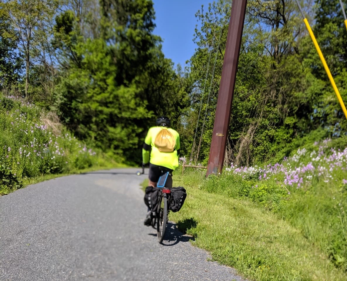
Made about eighty miles today, from Pittsburgh, PA to Lake Berlin, Ohio.

  
Robin and Justin left at five to get Justin back to Harrisburg in time for work, so I am on my own now. I was at the hotel breakfast bar at six and rolling out of Pittsburgh at seven am. 
The route towards Cleveland followed Route 51 northwest along the Ohio River. Google tried to take me to a dead and street with a bike path that itself deadended in a pile of gravel within 50 yards, so I ended up in the traffic on Carson Boulevard, and nearly got clipped by a city bus. A few miles further along, Google tried to avoid the worst of the hills by detouring to Bruno Island, but the bridge it tried to send me on was definitively closed for construction, so I was left with the formidable hills of route 51. So I did not end up crossing any of the fabled bridges of Pittsburgh.
Route 51 varied from nice shoulders to no shoulders. It is also known as PA Bike Route A. Somewhere around Aliquippa, it became a four lane divided highway with no shoulders and a tight guardrail, but traffic was light enough by then that I could take the lane.


In Monaca, I crossed the Ohio and the Beaver rivers, and 51 began its long slow climb out of the Ohio River valley. It narrowed to a two lane road, and I passed a prefab home manufacturer. Unfortunately, that meant that sever wide-load semi trailers hauling actual houses passed me on the road, with the house hanging out over the shoulder. I would never have known what hit me if one passed too close. At least the drivers seemed very aware of the potential mishap, and slowed down until they had room to pass or I could pull over.
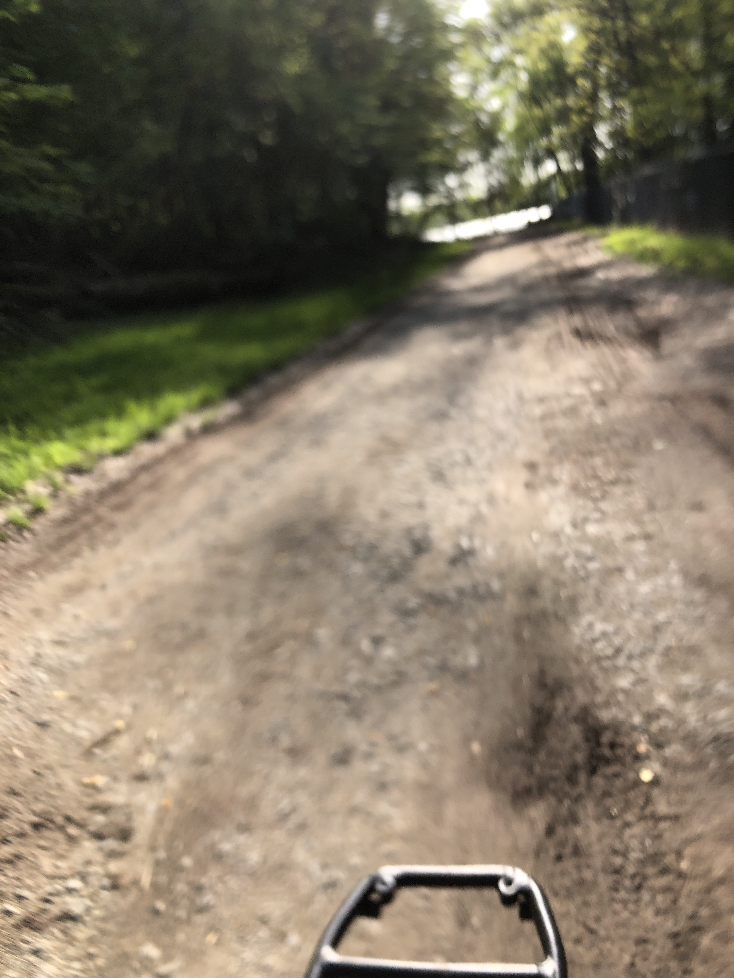
I crossed into Ohio at mile 45, and the road got bumpier. Pennsylvania,s industrial landscape had long since faded into countryside of dairy farms, woods, and meadows, I did my grocery shopping in Columbiana Ohio at the last supermarket I would see before the campsite, and ended up eating l7nch at Taco Bell because I managed to miss all the more local restaurants and wanted to make just one stop. My knees do better if I avoid multiple stops.

  
I am camping tonight at Philabaun’s Hidden Cove Resort and Campground in Deerfield, Ohio.


Tenth Leg – Out of the Mountains and Into the Industrial Midwest

   
We rode the 60 miles from Connelsville to Pittsburgh today. It was mostly an uneventful ride, as the woods gave way to towns and vacation homes, which gave way to the gritty industrial landscape from McKeesport to Pittsburgh. For the fist time, the sun shone most of the day. Justin set a fast pace, and my knees hurt more towards the end of today’s sixty mile ride than they did on the seventy-three mile ride yesterday. I think that’s because we hit some short, steep hills for the first time since starting the C&O Canal – and because of the quick pace.

   
Pittsburgh marks the end of the first phase of this trip. It’s the end of our family vacation with our son; Robin and Justin will be driving back east early in the morning. I have finished a week of daily long rides, and my legs and knees have not completely given out on me. I figured that if I was completely incapable of this trip, I’d probably know by the 0end of the first week. I am west of the Appalachians now – no more mountains to climb until I get to Wyoming – though I expect Ohio, Indiana, Illinois, and Nebraska will have some respectable hills to climb. I am going to have to pick up the pace when I get to the flatter part of the country. And there is good news – looks like the Cowboy Trail in Nebraska is mostly reopened after the big floods.


Leg Nine – Tunneling Through the Eastern Divide

5/14/19


We made 73 miles today, from Frostburg to Connellsville on the Great Alllegheny Passage. Frostburg lived up to its name with a chilly and drizzly morning, and we slept later on our BNB beds that in our tents the previous night. Between finding a cafe for breakfast, packing the gear we had left out to dry, and trying unsuccessfully to find raisins for homemade trail mix in walking distance, we got a late start on the trail – 10:30.

   
The bike trail climbed gently again for the first eight miles to the Eastern divide. The first highlight was the Big Savage Tunnel – 3900’ long, but lighted. The divide was not much farther on – at 2300’, it’s the highest elevation I will see until I get to the Great Plains. From the divide, we started down the longer and gentler grade towards Pittsburgh. We soon fell into a family draft pack. We let the 30 year old on the light road bike with skinny tires lead and pull his parents along, and we were soon making 12 mile hours. I rode cleanup since one wanted to draft behind my bike with the guitar neck sticking out beyond the wheel.

  
Our lunch stop was at the Rockwood Opera House and Mill Shops. One of the pleasures of bike touring is finding quirky little eateries along the way. This one had a model railroad set running around the wainscoting. The counter woman wore an engineers cap.

  
After Rockwood, the spectacular Salisbury Viaduct brought us into the Cassellman River gorge. The Pinkerton Tunnel was a little further down the way with a trestle over the deep gorge, leading to the 850’ (very dark in sunglasses) tunnel, followed by another trestle over the gorge.

  
This was beautiful riding through a lush symphony of laurels and hemlocks, and occasional stands of tall straight spring-green trees (sycamores?), with a bass note of the churning Casselman River down the steep bank to the right, and occasional tenor notes of the waterfalls cascading through rocks and laurels to the left. I don’t know if I have done a pleasanter ride through the woods. This is the landscape that inspired Frank Lloyd Wright; his Falling Waters house is nearby.
  
By the time we reached Ohiopyle, Justin”s rear tire was losing air. The bike shop was closed though (the sign on the door said it was usually open until five or six but sometimes closed at four). We kept stopping to pump air in the tire until we were stopping every mile, with fifteen miles to go. So we finally broke down and got out the patch kit. Fortunately the patch was successful, since we didn’t have proper size spare tube for Justin’s bike.

 
With the flat fixed, eager to make Connellsville before dark, we picked up the pace and through the evening woods at a fifteen mile per hour pace. We are staying at the Connelsville BNB because the 43 degree forecast is too cold for our sleeping bags. It’s great to see all the businesses that cater to bike tourists along the GAP trail – a long distance bike traveler feels welcome here, not the oddity

Leg Eight – Into the Rain, Into the Cold, Into the Stream, Into the Tunnels, Into the Gap and on to the GAP

May 13

Sixty Miles today – Fifteen Mile Aqueduct to Frostburg.


It didn’t rain much overnight after all, but in the morning it started raining while I fixed breakfast – with temperatures in the 40s. We got an early start despite the rain, since we let Danielle take the wet tents away. We immediately got lost trying to find our way back to the paved rail trail – at first it looked inaccessible on a trestle over the road, then the promising ramp to the right ended at a fence, while the parking lot across the street clearly provided access. After about two miles down the paved trail, it dead ended at a nonexistent bridge, a dirt road led in the general direction of the towpath, but that route also dead ended with a choice between a road submerged in a stream, or a gate marked “private”in the wrong direction. We eventually settled on fording the derailleur-deep stream.

The first highlight of the day was Paw Paw tunnel – a quarter mile canal tunnel through a hill that avoids a long bend in the river. It was nice to get out of the rain and ride with our lights through the dark tunnel.

After Paw Paw, we slogged the muddy and increasingly less maintained towpath with an early lunch and warm up stop at the restaurant in Old Town in mind, twenty miles down the towpath. When we finally made it, we figured out that the restaurant was closed on Mondays. So we slogged on in the cold rain. The next option to warm up and eat was not until Cumberland – another twenty miles on.  The trail got muddier and muddier, with 100 yard stretches of standing water hiding occasional deep potholes. Our bikes got caked in mud, so much so my front derailleur jammed again.

In the last five miles before Cumberland, the rain let up and we started to see some cyclists heading in the other direction. The Cumberland Gap was a welcome site, and marked the junction with the Great Allegheny Passage Rail Trail to Pittsburgh. We stopped at the Crabby Pig for lunch and to warm up and charge up.

After lunch we biked the fifteen miles to Frostburg, 1600’ of climbing up a gentle but unrelenting grade on a faster crushed stone trail. We had breaks of sun, and more rain, and we sheltered out the last storm  at the trail access shelter right below town. The Trail Inn advertises a bike wash and a laundry as one amenity, and we took advantage of it to spray the mud off our bikes and wash our clothes.

Tomorrow we are off to the Eastern Continental Divide and on down the GAP trail.

Seventh Leg – 40 Miles on the C&O Canal for Mother’s Day

5/12
We made about 40 miles up the C&O Canal towpath today.

I woke early to the sound of rain on the tent fly, which was expected. I checked the radar on my phone to look for a gap on the rain that would let us make breakfast and break camp. There was a bit of gap in an hour, and I boiled water for instant oats and hot cocoa while Robin packed up our tent and Justin roused himself.
The first part of today’s ride was a slow slog through a steady cold rain on a muddy, soft trail. My bike stopped shifting into high gear, but that hardly mattered because I didn’t need it. Our first landmark was going to be Fort Frederick, where the paved Western Maryland Rail Trail starts.

After over two hours of pedaling though the lush green – but cold – wilderness, we reached Fort Frederick and headed up the road to the fort restoration. We entered a bit of a time warp. After traveling through the deserted forest for hours in rotten weather at about the speed of a trotting horse, we reached the restored Wort’s General store, an outpost from the 18th Century frontier, with a sign offering hot coffee and a chance to warm up. We took advantage of both, as well as an ahistorical outlet for charging my phone, I also bought a miniature American flag as an ensign for my bike.
We dawdled at the fort restoration, standing in front of the barracks fire while the period interpreters, hungry for some visitors on a rainy Mother’s Day, regaled us with stories of life during the French-Indian war. We hoped the rain would stop before we had to set out again, but it didn’t.


Our next destination was Hancock, and a Mother’s Day lunch at a real restaurant. After a couple for false detours into truck stops, we found Buddy Lou’s Antique Shop and Restaurant. They were very nice and made space for us even without reservations. I now know that an order of crab fries will feed a family of four. Robin found a footstool she liked at the antique shop part of the place, so I piled that on the back of my bike along with the tent and the guitar.


It was still drizzling when we left Buddy Lou’s at 3:30, but we made quick work of the next twenty miles to the Fifteen Mile Aqueduct drive-in campsite, where Danielle met us with the dogs and a brand new camp dining shelter. We were the only people a the campground, so we changed sites to one with a better view of the Potomac and had a leisurely evening and dinner. Tomorrow promises more rain and a many more miles of riding – we are aiming for Frostburg, 63 miles away and well up through the Cumberland Gap.

Leg Six – Down the Burgs to the Mason Dixon Line

(May 11)

Today’s goal was Williamsport, MD to connect with the C&O Canal towpath trail along the Potomac. Google gave us three suggested routes – through Biglerville where Danielle’s parents live, through Gettysburg, or down the valley through Mechanicsburg, Shippensburg, and Chambersburg. I originally thought we’d go through Biglerville and drop in on Danielle’s parents, but it turns out that her father was away at a sailing regatta and their house is several miles and a long steep hill out of the way. So we settled on the flattest route for my longest day yet – 83 miles.


 Until now, I have been travelling light, since I was staying at BNBs and houses. Since Robin was driving out to Harrisburg to join me as far as Pittsburgh (and to drop the dog off), I let her bring my camping gear. Justin is also join8ng us to Pittsburgh. So we did a Father-Son ride 54 miles to Chambersburg, mostly flat riding with a tailwind and ten mikes of rail trail. Danielle dropped Robin off with our heavier gear in Chambersburg and we had lunch at the Old Oak restaurant. Somehow it turned out that my sleeping bag got lost in the shuffle. 


 Robin was fresh for the remaining 25 miles to Williamsport, so Justin an I drafted behind her, and we fairly flew down the road and across the Mason Dixon Line into Maryland.
I had just assumed that there would be a grocery store or market in Williamsport, which is a fair sized town that gets a lot of visitors to 5he C&O Trail. But there was nothing to be found except for the Desert Rose Sweet Shop and the Dollar General. And I thought food deserts were an inner city problem, not a rural one! Robin bought cakes and salads at the sweet shop, and I cobbled together a rice and canned chicken dinner from the shelves of the dollar general. 


 When we got down the hill to the river and 5he towpath, we discovered that the towpath link was closed for construction, and we had to bike back up the hill for the detour. No matter, we still made it to the empty NPS hiker biker campsite by five, plenty of time to make camp, cook, and eat before the rain came


 My foot feels much better today – the gel shoe insert seems to be working. Now my butt hurts more than my foot, which is the way it should be!

Fifth leg – Undulations of Road and Rain

Made the seventy five miles to my son’s house in Harrisburg today without too much trouble. I got an early start at 730. The bike route followed Old Route 22, parallel to Interstate 78, which was often in view, more often in earshot, and never more than one ridge away to the north. Old Route 22 rolled through dairy country in a never ending series of hills, none too steep or too long, but each one just enough to break my pace. The first two hours of the ride were in a steady cold rain, too.

  
Towns as such were few and far between. After five hours of riding and more than half the day’s objective, I promised myself I would stop for lunch at the next restaurant. Jonestown looked promising, a real collection of houses and churches on top of a hill. The first eatery on the way up the hill was a pizza joint but I decided to h9ld out for something more interesting. At the top of the hill, there were hardly any businesses at all in the town. I doubted I could sit down for lunch at the general store. My stomach rumbled as a rolled down the hill on the west side of town. But I wasn’t going to bike back up over the hill to the pizzeria. I got lucky, though. At the bottom of the hill on the west edge of town, a sign next to a brand new building announced that Ivana’s Italian Bistro was “now open.” I was the only customer.

West of Jonestown I had to decide whether to follow the Google maps suggested route on Route 22, or keep following Johnstown Road west. Graded four lane highway with incessant traffic and wide shoulders, or a rolling two lane road with the occasional dairy semi trailer full of milk or manure and no shoulder to dodge it.  After fifty miles of rolling hills, I chose the gentle grades of Route 22, but the traffic and commercial strips were a jarring contrast to the quiet country roads of the morning ride.

I also figured Rte 22 was more likely to have shops I could duck into when the afternoon line of storms came through. I could see the rain coming a mike away, and decided to check in to the Sleep Inn for twenty minutes. Or its portico, anyway. I don’t think the receptionist ever noticed I was there.

  
I Got to Justin’s house in Camp Hill right at five, and Justin and Danielle had cold beer and snacks ready! 

My legs feel fine, but my right foot has swollen up from the pressure of the bike cleats, I think. I am going to try some gel inserts in my bike shoes for tomorrow’s ride.

Leg 4 – Rolling Up The Lehigh Valley

  
Made a mostly easy 65 miles today, for a trip total 188. NJ route 57 ran down the Muscanetcong River for the first eight miles or so, and with a gentle tailwind and cool weather, the easy rolling start made 120 mile days seem plausible later in the trip. But the hills started rolling once I climbed out of the valley, slowing me down a little on the way to the Delaware crossing in Phillipsburg. I crossed on the historic Northampton Street bridge. The officers on duty at the bridge told me in no uncertain terms I had to walk my bike on the pedestrian path.

  
 Once in Pennsylvania, my route followed the D&L Canal towpath for nearly 15 miles of flat spinning through the woods, with the Lehigh River on one side and stretches of the old canal reflecting on the other. Though the path had its rough sections, some dirt, some gravel, some mud, and some crushed stone, I made great time easy pedaling the flat terrain. Wood thrushes fluted me through the green canopy and evening Hesperus was blooming everywhere, sweetening the air.

  
The Lehigh ride was mostly pretty bucolic, but it included some stark industrial vistas, like this giant decrepit steel plant near Bethlehem. And it finished off with the screeching sounds of the railcar sorting yard in Allentown.

  I left the Lehigh River in Allentown, whose suburbs stretched interminably to the west, then morphed into a Mecca of regional trucking centers. A steady line of semis kept me pinned to the narrow shoulder on Route 222. I finally stopped for a late lunch/early dinner at the Starlite diner in Fogelsville, where I was delighted to learn that I was eligible for the senior discount at the all-you-can-eat soup and salad bar.
Another half hour of cycling mercifully took me away from Route 222 and into peaceful Mennonite farm fields and the Tinkerers Farm AirBNB somewhere way up a long lane, far from the noise and trucks. And there was a nice hammock in the back to put my sore legs up for a while.

  
Today’s Google routing mishaps:

The route out of Hackettstown directed me straight to the entrance of the State fish hatchery, with a big “Not open to the public” sign, then veered left onto a bike trail marked “Authorized Admittance only.” That bike path led me to the sports field of the local high school, where Google told me to turn right into a chain link fence. It took me a half mile of circling to find the route again – but as I passed the school parking lot from the other side, I saw the small gate in the fence I was meant to use.

On the PA side of the Delaware, Google sent me right through a gate marked “No Trespassing Norfolk and Southern Railroad.” But the dirt road on the other side did eventually connect to the canal towpath.

Up in farm county, Google tried to tell me I should follow a tractor wheel track through some farmers’ fields. I followed the road instead.

Third leg Thrice Across Jersey on Rails, Roads and Google Trails

46 miles today, for a total of 123 since leaving the Atlantic at Coney Island.

Today’s bike destination was Hackettstown, NJ. I picked Hackettstown because it was the furthest west you can go and still take a train back to New York City – the end of the NJ Transit Morris and Essex line. There was one NYC event that I could not skip for my bike trip- the Riverkeeper Fishermen’s Ball benefit, where the Pace Environmental Law Program was an honoree. So I booked an AirBnb for the night, figuring I could hop a mid afternoon train for the evening event. But when I checked the schedulle it turned out that the last train that would get me to the city on time left at noon.

That meant getting a really early start to try to arrive at 11 to leave time to shower and change and walk to the station. So I left David’s at six am and rode west through the sleepy suburban hills of Verona and Hanover, following the track the Google maps bicycle routing function laid out for me.

But stoplights, wrong turns, the maze of little roads Google sent me on, and an interminable hill out of Morristown slowed me down, and I began to seriously doubt I would make that noon train. But then after a near head on collision with a car drifting across the center lane while I zoomed down the backside of the hill, and a missed left turn, Google showed me to the Black River Swamp bike path, which meant some flat uninterrupted miles slowed only by the soft path and occasional mud slicks. Suburban houses gave way to woods and horse farms, with the scent of spring blossoms in the air.

I was pleasantly surprised by how much of today’s ride ended up being on bike paths maybe as much as ten miles worth. 

   
I have mixed feelings about the Google bike mapping function though. Google has a knack for finding routes on little roads with no traffic – and for finding bike paths you never would have known about.  You find yourself heading down a suburban cul de sac with no apparent outlet and then there’s a bike path at the dead end. Or the bike path drops you off at a high school parking lot, and Google seems to think you should ride across the basketball courts to get to the continuation of the bike path. 

 I transfer the Google routes onto my Runtastic bike app because I find the Google voice directions really confusing, and I don’t want to waste the phone battery. So I try to navigate the thick gray line that the Google route lays over the Runtastic base map, obliterating road names. Sometimes I have to ride a few hundred yards past an intersection to figure out whether I am still on the right track.


Then there are the times the Google bike routing function goes really wrong. Try mapping the route to the top of Bear Mountain in Harriman State Park, and the Goog will try to send you up the Appalachian Trail. After some pleasant miles on the Black River trail and the Columbia bike trail, Google tried to send me up Schooleys Mountain on a hiking trail called “Patriots Path.”  

  Google wanted me to bike up this on a road bike! The alternative was Schooley’s Mountain Road – which earned its name, with a steep 500 foot climb. But the downhill on the other side dropped me into Hackettstown at eleven am, right on time.

   
The Everett House B&B looks just like a B&B should, and was a sight for a sore cyclists eyes. Especially with a fridge full of snacks and a note from the hostess that I should help myself to any food in the place.

  I ate, showered, changed, hopped on the noon train to Hoboken and graded most of my environmental law final exams while the same New Jersey landscape blurred past outside the window. I met Robin at the Riverkeeper event, delivered my remarks without a hitch, and we were all treated to Debbie Harry (recipient of the Riverkeeper Big Fish award) giving an inpromptu performance.

  
Robin is driving me back to Hackettstown and my bike journey, so that makes it three Jersey crossings today, by trails, rails, and roads.

Second Leg – West Nyack to Montclair

Picked up my exams to grade, got home, and hopped on the bike at 4 pm. My electric motorcycle and car are jealous they can’t go on this trip, but the bicycle is less range challenged than my EVs.

  Robin and Nara met me at the Joseph Clark rail trail with an ice cream cone, and rode the fourth mile with me. But Nara is a little logey in the warm weather so we parted company at the 303 bridge. Nara really wants to run across the country with me too.

  
This was an easy first day on the road just thirty miles, mostly flat. It was supposed to be 27 miles according to Googlemaps, but I made a wrong turn in Haworth and that added two miles, plus my cycling app always seems to add five percent to Google calculates distances. I was racing the thunderheads towards the end, but I beat the rain.  Destination was my brother David’s where my dear sister in law Jill laid a nice send-off meal. I’ll have to decide whether to put the lamb chops on my carbon tab for the month! Tomorrow will be a super early start.