49th Leg – Slow Walking the Redwood Run to the Pacific, and the Journey Ends

6/29

I made the last 30 miles to the Pacific Ocean and Crescent City, California today. End of story.

Friday evening beers at the Patrick Creek Lodge yesterday felt like a homecoming to a place I had never been – it felt like happy hour at Garnet Hill Lodge. The patrons were local fishing guides and they all knew each other’s story. I was welcomed. The lodge even has the feel of GHL; it was built in the 1920s and has a similar added dining terrace. But the crowd was sparse, and the owner looked nervously at all the elegantly set but empty dining tables on a summer Friday evening.

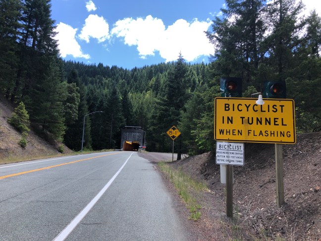
This morning, I took my time breaking camp for the last time and hit the Redwood Highway traffic at around eight. It was a pretty run through the Smith River canyon, making frequent picture stops and pulling over to let traffic by on the narrow stretches. I don’t want any motorist to have to choose between a head on with a truck coming round a bend and a soft target like a cyclist.

Fifteen miles down the road, I left the Redwood Highway for the actual redwood trees on the Howland Hill Road through the Jedediah Smith Redwoods State Park. Unpacked, but hard packed and easy rolling, I was soon lost in the winding way through redwood trunks. For the trunks are all you can take in at once. Or the tops, but that makes you dizzy on a bike.

I stopped at Stout Grove for a slow stroll around the redwood path, among other travelers equally awestruck and silently reverential. The peaceful timelessness of that place will stick with me for a long time.

Back on Howland Hill Road, I went as slow as I could, coasting the flat stretches, braking down the hills, slow pedaling the rises. Unlike the cornfields of the Midwest, the mountain passes of the Rockies, and the sage deserts of the Great Basin, I did not really want to reach the other end of this forest.

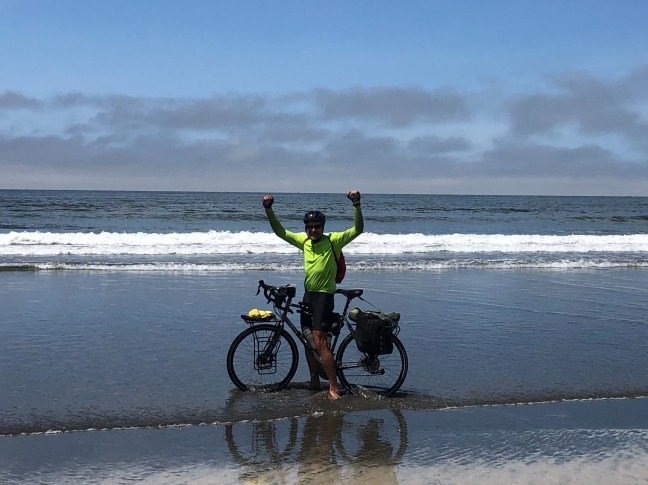
But after one last rise, Howland Hill Road burst out of the redwoods onto pavement, and down the tight curves of the steep descent I caught my first glimpses of the blue rim of the Pacific Ocean. I stopped to take a picture, then as it sunk in that I had ridden ocean to ocean across a continent I laughed out loud and whooped, though there was no one to hear my solitary exultations.

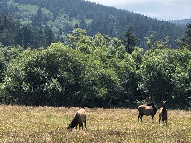
At the bottom of the hill, a herd of elk grazed lazily near the intersection of Highway 101. I took my time getting to the beach, riding first to the Crescent Beach Overlook, before riding down to Crescent Beach itself, stripping off my bike shoes, and dipping my tires in the wash of the Pacific Ocean, where I sat contemplating the western horizon for an hour before the afternoon fog rolled in.

Advertisement

Leg 48 – One More Mountain Range, One More River, One More State: Down the Redwood Highway

Coast Range, Smith River, California. I made 75 miles today to the Patrick Creek Campground in the Smith River National Recreation Area, though 11 miles of that was backtracking to Merlin. I am only about 20 miles from the Pacific Ocean now, though a bit farther by road.

I was only thirty road miles from the Pacific where we took out from our four day raft trip down the Wild and Scenic Rogue River, but I didn’t work out the logistics of having the bicycle delivered to the take out. Plus that would mean I didn’t actually bike all the way across the country. Plus, I decided that I really should go the extra thirty miles or so to see one more natural wonder of our wonderful continent – the redwoods of Northern California. Also, the weekend bus connections to Vancouver were better from Crescent City, CA than they were from Gold Beach, OR.

I got an early start, in part since I got to bed early in order to sleep off the four days of excess stimulation and alcohol running the captivating narrow canyons and difficult drops of the Rogue and camping with my friends. I was on the road by 6:15, watching the sunlight and morning mists on the high ridges around the Rogue.

On the way in last week I noticed a sign for Route 199, aka Redwood Highway, via a forest service road just two miles from Galice, but when I checked that road out on Google Maps, it showed a 4000’ climb, stretches of gravel, and just as many miles as the preferred Google route of backtracking to Merlin, then riding Oregon 260 to Rte 199.

So I stayed on the paved roads. I did not expect to see coffee before Wilderville at mile 25, but there was a little gas station and convenience store at mile 18, so I stopped for coffee and and an unexpectedly good blueberry muffin there. I was a little self conscious about locking my bike up in a small town, but the sign in the bathroom said “Drugs Are Illegal In Oregon Please Don’t Flush Your Needles Down the Toilet,” so maybe it was a good idea. More than one person has described this part of Oregon to me as being full of meth heads who will rob you blind, though I don’t think I have met any.

Several people have warned me about Rte 199 being one of the most dangerous roads in America, too. But when I reached it near Wilderville, it had nice wide shoulders, of a lot of traffic. I climbed one hill to get into the Illinois River Valley, and eventually reached Cave Junction, where I planned my lunch and groceries stop.

I was there a little early, so I rode the the west side of town then backtracked a few blocks to Taylor’s Sausages, which offered a lunch menu in addition to cases and cases of sausages and smoked meats. I sample their chicken-apple sausage in addition to a crispy chicken salad and fries. While I was eating, the Maitresse D’ slid into the bench by the upright piano near my table and began belting out ragtimes.

.

After Cave Junction, the road climbed and climbed and eventually reached a sign saying “Welcome to California.” I biker on a motorcycle from Tennessee was standing by the sign and we chatted about cross country two wheeled travel. His butt gets sore, too, but he has only been riding about eight days to get here, plus some family stops along the way.

At the agricultural inspection station, the inspector waved me on, but warned me to “be careful in the canyon.” Then the road went through a tunnel and deposited me in the Smith River canyons, another ten miles of mostly descending curvy and narrow roadway that was not the worst road I have ridden on. I got to the campground at three thirty, and once again was glad I reserved ahead, because it looks like they are full.

I think I will take a walk up the Patrick Creek trail, which apparently leads to a lodge where they will have beer and they might even have WiFi.

Leg – 47 To the Rogue Camp Paella Among Friends

6/23 (Posted late)

This was a short day of riding, just 23 miles from Grants Pass to Almeda Park Campground at our Rogue River put in.

Bart stayed with the group in Eugene last night as it turned out, but showed up with his truck this morning at ten and we went to the Safeway to get paella provisions and other groceries for the raft trip. I also picked up some cheap river shoes at the Bi-Rite.

The road out of Grants Pass really is a pass, and the ride out started with a climb and a drop. Then I got to Merlin in no time and pulled into Morrison’s Wild Rogue outfitters, where my friend Donna greeted me, laughing that I had beaten the crew in cars on my bike. The rest of our rafting group arrived soon. It feels good to be among friends again. We had lunch and beers in Merlin.

I got a head start for the 15 miles to the campsite, and was soon treated to some splendid Rogue River vistas. There was plenty of cold beer at the campsite, and everyone agreed that the wood fired paella was the best ever

.

I am going to spend the next four days on the river, then resume my ride for the last 100 miles to the Pacific on Friday

Leg 46 – Down the Rogue River Valley to Grants Pass

6/22

I made 79 miles today, down the Rogue River valley to Grants Pass, Oregon.

I got a reasonably early start this morning, around 8 am. It took forever for my breakfast water to heat up – 70% alcohol just doesn’t burn as well as 90%, especially on cold mornings.

I stopped close to the campground to visit the Rogue River Gorge, and then the Natural Bridge. Both are places where the Rogue rushes through lava tunnels – even disappearing underground in a rushing torrent at the natural bridge.

The next twelve miles slid by in a dream. With the cold morning air, long slanting rays of sunlight, slight downgrade, and the grandeur of improbably tall Douglas firs lining the road, I felt I could ride this road forever and never tire of it. I did not want it to end. I did not want this trip to end.

At mile twelve, I left the National Forest, and a sign for Prospect promised a cafe a half mile from the route. It was early to stop, but I had not had any connectivity for days, so I opted for second breakfast at 930 am. Thei blueberry pancake breakfast at the Prospect Trophy Room included eggs and bacon. And coffee. And good WiFi.

After Prospect, the landscape opened up again, to irrigated farms and dry looking orchards, and even some vineyards. There was more climbing than I expected. I happened on to a bike path that Google seemed unaware of, then got a little lost when I shut off the google voice telling me to get back on the shoulderless, heavily trafficked roadway. Then the bike path ended abruptly, leaving me on an unknown road generally headed in the right direction. But I made it into Grants Pass by 430, and checked into the Motel 6 because I could use a clean-up and campsites are likely to be scarce this beautiful Saturday evening, One of my raft trip friends will join me here later on.

Leg 45 – Crater Lake to the Rogue River, and Its All Downhill From There

6/21 (posted late)

I pedaled 41 miles today, but most of it was playing tourist at Crater Lake National Park. Still, I am sixteen road miles closer to the Pacific at the end of the day, so this counts as one more leg of my journey.

.

The first night of summer was the coldest night of the trip – there was a heavy frost on the bear cache and picnic table by my tent this morning. I am traveling with a very light and compact fleece sleeping bag that is only good to fifty degrees. On cold nights like last night, I wear all my warm clothes and throw a space blanket over the top of the bag, and I slept comfortably enough. I woke up early out of habit, but took my time breaking camp. A Stellars Jay tried to fly off with my oatmeal package while a chatted about my trip with one of the other campers. Mazama Village is an enormous campground, but as far as I could tell I was the only person in an actual tent

My goal for the day was mostly to play national park tourist. I left my gear with the campground registration desk – no reason to drag it 2000 feet higher to the rim. The road climbed gracefully through the tall trees. I stopped often, including at the visitors center. Finally, after a series of hairpin curves with snow on the edge, the road crested the rim and I was absolutely awestruck by Crater Lake. I spent some time right away walking along the path and taking pictures. They were out of coffee at the cafeteria, so I had a hot cocoa and confirmed that the WiFi was no better up there than down at Mazama.

The East Rim road is still closed for snow. After my cocoa break, I rode along the west rim road as far as the Watchman lookout, about five miles along. I was hoping to climb the Watchman, which is listed as a “moderate” 1.6 mile hike, but the trail from the lookout was closed due to snow. Perhaps the other end of the trail, facing south, would be open, so after taking in the view, I headed back downhill a mile. There was no closure sign at the parking lot, so I walked along the trail about half a mile before coming to the trail closure sign. I considered pushing on, but reminded myself that this is a bike expedition, not a snow mountaineering expedition, for which I was ill equipped. I sat down on a crag and soaked up the deep blueness of Crater Lake, then enjoyed my solitary walk through the tall dark trees that framed the bright lake and snowy cliffs. On the way back I found an even more spectacularly crag to sit on and take in the whole sweep of the caldera.

I went back to Rim Village for lunch at Crater Lake Lodge. It was a long wait for lunch, but my lunch came very quickly once I was seated. I later learned that I was mistakenly given the neighboring table’s identical order – salmon over linguini, and clam chowder. Lunch is a great way to experience this great wilderness lodge on the cheap. There are no signs telling you there is a restaurant open to the public – you have to ask.

After lunch I put all my warm clothes back on for the descent to Mazama Village. It all went by in a spectacular blur as I took the hairpin curves as fast as I dared on my nice new tires. At Mazama I shopped for a bare bones dinner – spaghetti and bottled sauce, picked up my gear and a beer at the restaurant to drink later, then headed down Rt 62.

Or rather up, since I had just a little more climbing to reach the watershed divide between the Klamath and the Rogue. Another landmark at the height of land – the Pacific Crest Trail – so I have ridden from the AT to the PCT now.

After that, the road descended in a twelve mile winding delight of tall trees and dark woods. I reached the Farewell Bend campground on the Rogue River at five, and it is a good thing I reserved a site, as they were full up. I set my tent up on the bank of the Rogue, another goal achiieved

Leg 44 – Through the Sun Pass Labyrinth to Crater Lake National Park

6/20

I made 30 miles today to Mazama Village in Crater Lake National Park – not a big day in miles, but my Runtastic App says I climbed over 6,000 feet.

I had no cell phone or internet last night or most of today, so I had to work from routing info I saved at the cafe yesterday. Google’s preferred route to Crater Lake takes a backdoor to the East Rim Road, which I knew to be closed due to snow. The second and third routes followed Sun Pass road to the top of Sun Pass, then navigated a maze of forest roads to Route 62. Although Sun Pass Road also went to Route 62, it looked like it made a steep side hill 800 foot drop from the Pass, which would not be fun on unimproved roads on a road bike.

I knew my way back to Sun Pass Road, which was fairly easy rolling on semi-improved hard gravel. Fortunately I had made a screenshot of the maze of forest service roads, and the Google base map was good enough to locate me among topographic features, even if the roads were missing, so I had a pretty good idea of where I was most the time. When the time came for the turnoff from Sun Pass Road, there was a barricade across the road. But the sign just said it was closed to wheeled motorized vehicles; snowmobiles and hikers were specifically welcomed, so I figured it was open for bikes.

The hard sand road made a beautiful, mostly smooth drop through the forest, with mountains peeking through the tall trees. Piles of pine cones, and some washout ruts and potholes kept my attention and my brakes engaged, though. At the bottom, I needed to check the map to confirm the sharp right turn onto a good gravel road. This road was easy to follow for a while, but eventually petered out and became indistinguishable from the maze of sand tracks. With multiple mapchecking stops, and minimal backtracking, I managed to find the right route as it hooked north, then west, the south, then west again to join Route 62 at a Volcanic Scenic Byway information sign.

I ate lunch, then went to pump my tires back up to pavement pressure. But when I removed the valve cap from my front tire all the air whooshed out. Good thing I have spare tubes now, I thought. But it turned out that the valve on this tube can be unscrewed from the stem, and it was a simple matter of screwing the valve back in.

Route 62 soon crossed the boundary of Crater Lake National Park, and climbed and climbed and climbed along the rim of Annie Creek Canyon. I made plenty of rest and picture stops, and got to Mazama Village at around 2:30, where there were campsites available, a grocery stocked only a little bit better than the Silver Lake market, and a fireplace, cold beer, pricey kale salad, and slow WiFi at the restaurant. No pictures with this post because the WiFi is too damn slow!

Tomorrow I will ride up to the rim road

Leg 44 – Through the Sun Pass Labyrinth to Crater Lake National Park

6/20

I made 30 miles today to Mazama Village in Crater Lake National Park – not a big day in miles, but my Runtastic App says I climbed over 6,000 feet.

I had no cell phone or internet last night or most of today, so I had to work from routing info I saved at the cafe yesterday. Google’s preferred route to Crater Lake takes a backdoor to the East Rim Road, which I knew to be closed due to snow. The second and third routes followed Sun Pass road to the top of Sun Pass, then navigated a maze of forest roads to Route 62. Although Sun Pass Road also went to Route 62, it looked like it made a steep side hill 800 foot drop from the Pass, which would not be fun on unimproved roads on a road bike.

I knew my way back to Sun Pass Road, which was fairly easy rolling on semi-improved hard gravel. Fortunately I had made a screenshot of the maze of forest service roads, and the Google base map was good enough to locate me among topographic features, even if the roads were missing, so I had a pretty good idea of where I was most the time. When the time came for the turnoff from Sun Pass Road, there was a barricade across the road. But the sign just said it was closed to wheeled motorized vehicles; snowmobiles and hikers were specifically welcomed, so I figured it was open for bikes.

The hard sand road made a beautiful, mostly smooth drop through the forest, with mountains peeking through the tall trees. Piles of pine cones, and some washout ruts and potholes kept my attention and my brakes engaged, though. At the bottom, I needed to check the map to confirm the sharp right turn onto a good gravel road. This road was easy to follow for a while, but eventually petered out and became indistinguishable from the maze of sand tracks. With multiple mapchecking stops, and minimal backtracking, I managed to find the right route as it hooked north, then west, the south, then west again to join Route 62 at a Volcanic Scenic Byway information sign.

I ate lunch, then went to pump my tires back up to pavement pressure. But when I removed the valve cap from my front tire all the air whooshed out. Good thing I have spare tubes now, I thought. But it turned out that the valve on this tube can be unscrewed from the stem, and it was a simple matter of screwing the valve back in.

Route 62 soon crossed the boundary of Crater Lake National Park, and climbed and climbed and climbed along the rim of Annie Creek Canyon. I made plenty of rest and picture stops, and got to Mazama Village at around 2:30, where there were campsites available, a grocery stocked only a little bit better than the Silver Lake market, and a fireplace, cold beer, pricey kale salad, and slow WiFi at the restaurant. No pictures with this post because the WiFi is too damn slow!Tomorrow I will ride up to the rim road

Leg 43 – Out of the Desert and Into the National Forests

6/19 (Posted late due to no internet)

I made 83 miles today, from Christmas Valley to the Scott Creek Campground 25 miles south of Chemult, Oregon in the Winema National Forest.

One challenge today was a Waterkeeper Board meeting scheduled for 9 am to noon Pacific Time. I couldn’t afford to delay a desert start to an eighty mile day until after noon, so I needed to make some miles before the call. Fortunately, there was a small town called Sliver Lake, with a cafe, and (according to AT&T) cell coverage. So I actually set an alarm for five am, woke up at 4:45 without the alarm, had motel Mr Coffee, two bananas, two cherry pastries, and an orange juice as a down payment on breakfast and actually hit the road before six am.

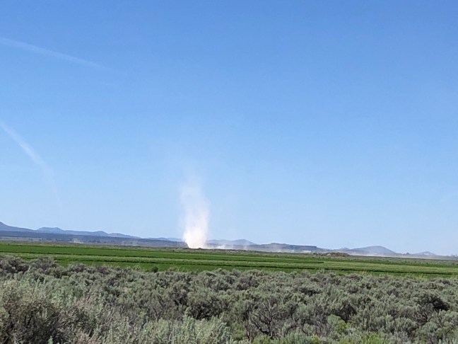
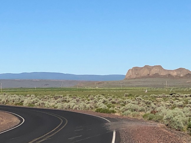
My new firmly inflated tires rolled easily down paved Old Lake Road in the long clear light of the desert dawn. And the desert is cold in the morning! But the scenery was interesting, and the sage desert faded to green irrigated fields. By the time I reached Route 31 the hills were not just dotted, but blanketed with pine trees.

I reached Silver Lake in plenty of time, so I went shopping for dinner at the Silver Lake Market, since I did not expect to see another store. The cavernous market had the air – and a little of the odor – of a building that devoted most of its life to the repair and maintenance of internal combustion engines. Pickings were slim. I settled on Vienna sausages and sauerkraut (that’s a vegetable, right?) for dinner, with the one Chobani yogurt in the fridge case as dessert.

I went back to the Cafe, and made a test call to Robin to see if one bar of cell was enough. For second breakfast I ordered the “classic” – eggs over hash browns, with sausage and toast and endless coffee. I kept getting dropped from the phone call, but fortunately the cafe had WiFi and I could use it to connect to the meeting.

After the call headed west out of town and turned left on Bear Flat Road, which led into the Fremont National Forest. And there were trees! At first, short pines dense enough to provide a windbreak, but not tall enough to cast a shadow. At last, I was through with battling headwinds in treeless plains! And as the road ascended, the trees ascended as well, becoming towering red barked

pines shading the road – shade that was hardly needed in the still cool air. And the scent of pines and the whisper of the wind in their needles told me I had finally left the desert for the Forest. (Oregonians seem to think that the high desert can be full of trees, that’s fine, I’ll take my desert with trees thank you). Glimpses of the snow clad cone of Mount Scott showed up on straight stretches of road. To be sure, stretches of forest showed evidence of logging activity, and a few logging trucks passed me in the opposite direction, but I was grateful for the forest anyway.

When it got to be lunchtime (a little later than usual, given second breakfast), I really wanted a stop with a view of Mount Scott. I was almost ready to give up when the road passed the Klamath Marsh National Wildlife Refuge Headquarters and descended to a huge open wet meadow with a dramatic view of the peak. So I stopped for lunch, then went back to take a picture of the crossing of the Williamson River.

After lunch, the road through the wildlife refuge rose to a ridge then dropped even more spectacularly into Klamath Marsh itself – ten miles of causeway across marshlands with Mount Scott towering over it all and other snow clad peaks in the wings.

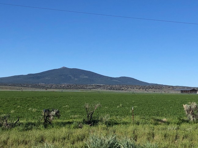
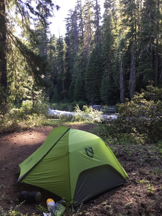
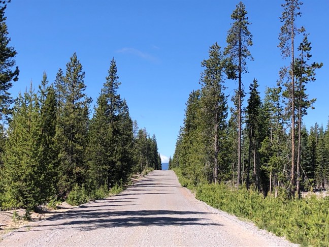
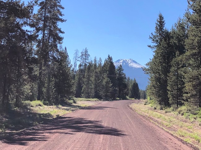
At mile 78 for the day, I reached Rte 97, and crossed it to the Forest Service Road that would provide access to the campground. It was tough going in the soft, fine, red gravel. My new tires are a little skinnier than to old ones – 35mm instead of 38, and they sliced and sank right into the gravel. I could barely make the bike move and stay upright – and it was five miles to the campground. So after going to all that trouble for firm tires that didn’t leak . . . I let some air out of both tires, the flatter treads floated and gripped a little better in the gravel, and I could find a good line to ride at an acceptable clip. The route went from gravel to hard dirt deep in the woods – an easier ride – and eventually dropped into the shallow ravine where Scott Creek flowed and the empty campground awaited me.

And here I have peace and solitude – deep in the tall trees lit by the slanting rays of the evening sun, the only sound the gurgle and hiss of the clear flowing creek. There was plenty of firewood and kindling, so I started a fire to cook, purify water, and maybe keep the bugs and bears away. My solitude was disturbed only briefly when a pickup truck with a couple of men riding on the tailgate stopped to fill several large containers with water from the creek crossing. Later, a small crossover SUV drove in and out of the campground several times before settling at the far end of the campground, but they were very quiet and I might as well have been alone in the wildernelss

Leg 42 – Around the Sand Desert to Christmas Valley

6/18

I made 86 miles today in the lonesome desert to Christmas Valley, Oregon, including 6 miles of backtracking to Riley.

I woke at five and thought I could sneak another fifteen minutes of sleep, but didn’t reawaken until 5:45, so I got a later start than I wanted. At seven, I said goodbye to my erstwhile pedaling companion, and hit the road, after filling my two water bottles plus an empty 32 oz Gatorade bottle Dave gave me.

Google’s preferred route to Christmas Valley would send me west another 20 miles on 20, then “turn left” on an unnamed Jeep track. I had asked Randy, the BLM Campground caretaker, about the google route yesterday evening – Jena said it was well worn and would be spectacular, traveling past Obsidian Butte and the sand desert. But it would be soft sand. And I was wary of taking the chance of having an unfixable flat on an untraveled road in the desert 30 miles from any habitation, and with limited water.

The alternate route backtracked to Riley, then went south 35 miles on US 395. With an unusual dawn wind blowing from the west, it was an easy choice, and at least the backtracking was quick and easy pedaling.

I bought some coffee for the ride at Riley’s Market and Archery, and topped off my water bottle again. Although there was a place called Wagontire 28 miles down the road, the owner of the Riley store wasn’t sure I would be able to get water – I might find the “caretaker” there but I might not. On Google Maps, it shows something called the Wagontire International Airport.

The sign leaving Riley said “Next Gas 90 Miles.” I was immediately in empty sage desert, with some background buttes and cones. Although much of the road was fenced, few cattle were to be seen. The early morning riding was pleasant enough, cool and still for this stretch.

At 21 miles, I stopped for the 3pH: Pee, Pictures, Pump, hydrate. My rear tire, which had not been a problem until now, was also going soft, worse than the patched up front tire. So I pumped it up.

The sign at Wagontire advertises gas, a cafe, RV parking and groceries, but it was all boarded up, with no sign of an airport even. As I glided by, I saw a man in a sun hat tending a flower garden.

I was then on the lookout for the Wagontire-Christmas Valley Road. I did not know which mile it was at or whether it was paved. Fortunately, Google MPs saved the base map, so even with no cell service, I could tell where the turn was. It was indeed paved, with enough sporadic traffic that I knew I would not die out there in the desert no matter what.

I put off lunch as long as possible, since I wanted to make as many miles as possible before the west wind blew in earnest. At mile 60, I reached a ridge and noticed a plume rising skyward from the horizon. Was this a dust storm in the sand desert? As I rode on, the plume took the form of a line of rising smoke in the valley. I decided it must be a wildfire. But traffic passed in both directions without concern. I finally stopped for lunch on the full sun at mile 67 for the day, at a bend on the road by an open sand area. Just as I got there, a strong whirlwind stirred up a huge dust devil that almost stopped me in my tracks. Maybe the plumes were all dust storms after all.

After lunch I rode the remaining 20 miles to Christmas Valley, puzzling over the plumes. When I finally passed the plumes to the south, just a few miles east of town, they looked like steam vents or geysers, and I decided they must be geological activity of some sort.

I checked into the Christmas Valley Desert Inn at 5, but no tire package had arrived. The owner said UPS usually would have delivered by then, unless they were running late. In my room, I tracked the package, which was still out for delivery. I showered and researched the next few days plans – then came a knock on the door – my new tires had arrived! It was like Christmas Day in Christmas Valley!

I checked in with Robin, and mounted the new tires and tubes. I went to dinner at the Farmhouse Cafe, where the counterwomen told me the smoke plumes were all dust blown by the wind. After dinner, I bought bananas and beer at the grocery store, and ended up chatting with the occupant of the next unit, who was driving the Schwans Food delivery truck. He said the farm kids here were all rich, but the others were dirt poor, many families without lights or running water. And that the Bundys were actually nice people. I pointed out that armed occupation of a federal office wasn’t a nice thing to do, and he agreed.

I have been riding in the desert for six days now (not counting a day of Snake River Valley). I am ready for a change. I have one more desert to cross, but I should be in the Klamath National Forest by the end of the day tomorrow. Hopefully, there will be trees there